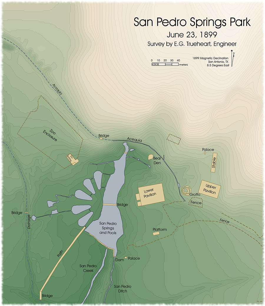
A view of San Antonio's historic San Pedro Springs Park from a detailed 19th century topographic survey.
E.G. Trueheart's 1899 Survey of San Pedro Springs Park
In June of 1899, Edward G. Trueheart conducted a highly detailed topographic survey of San Pedro Springs in anticipation of the upcoming renovations to the park. The survey shows a large hill that dominates the northeast quarter of the park which was later blasted almost completely away. A 1909 article in the San Antonio Light entitled "Indian Tomb Yields Dead" (March 9, 1909) describes the discovery of burials and artifacts within this large natural landform before it was destroyed.
Trueheart's map shows the "Bear Den" and the original location of the zoo on the park grounds. It also shows the path of the acequia through the park and the five large pools that were filled in during the restorations at the turn of the 20th century.
Trueheart conducted an alidade survey to create his 1899 map, a method that provides a high degree of accuracy and detail. Unfortunately no absolute reference was given for the elevations, which limits possibilities for comparison with modern elevation data.
Reconstructing the Survey
Over ten different scans of the large historic map were mosaicked together and georeferenced in GIS. The map was then digitized, including the spot elevations and interpolated contour lines. This elevation data was then used to create two- and three-dimensional representation of Trueheart's 1899 map.
The three-dimensional representation of Trueheart's map intuitively shows the park's historic topography and system of drainages. Future work will include modeling water flow through the park using Trueheart's elevation measurements.
This and other Trueheart maps are located in the City Engineer Map Collection at the City of San Antonio, Office of the City Clerk, Municipal Archives & Records. The final digitized version of Trueheart's map is shown below.